Stanford At Sea student Jessica Hinojosa uses a sextant to estimate the ship's latitude
We are nearing the end of our 15 day journey from the Marquesas to Hawaii. Strong trade winds have been in our favor for the past few days, blowing 20-25 knots. The sun has been shining, and dry air has been a welcome change from the moist tropics. We've pretty much eliminated the “mung” from our clothes and the ship, which accumulates from the wetter tropical portion of our trip. We’re sailing at high speeds of up to 9 and even 10 knots, with 6h of science stations daily. We’ve been making about 110-120 nm a day.
We are within a 100 nm of reaching the Big Island of Hawaii- where potentially tomorrow we will be close enough to witness lava flowing into the sea, producing clouds of steam - giving us a visual record for this tectonic hot spot. We’re not exactly sure where the lava is going into the sea, but hope to pinpoint the volcano flow by the afternoon. It has been a long journey home to the US- we’ve passed the 3100 nm mark in our ship’s log -- a trip full of adventure, exotic natural beauty, and spectacular sailing. We’ve used the motor very little in comparison to past trips north; we came on this leg from the Marquesas a lot further to the east than our prior trips up from Palmyra. We have had the wind pushing us north with steady breezes on the beam the entire way.
We are conducting our last biological collections today- a deep Tucker trawl- probing the depths to examine the biodiversity of the Deep Scattering Layer. This station is a comparison to our low oxygen stations earlier on the leg. We will be finishing our work in the North Equatorial Current by tomorrow. We’re hydrocasting now to 1000m and putting the final touches on the oceanographic section we’ve created from sailing and sampling from about 15 S to 19N. Students are pulling together their individual projects to start the process of presenting their results in formal talks and writing up the final project papers due on Friday.
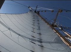
We plan to sail along the Kona coast of the Big Island on Tuesday- a remarkable coast with epic history of encounters. I could not help but wonder today how the Polynesians could sail and paddle their early vessels through the blustery conditions of the ITCZ. I understand better now how stars such as Arcturus or Vega made navigating a bit easier- but wonder what it took to make such arduous journeys. The oral history of Polynesians included a knowledge of stars that far exceeds our own- but students on this trip have made almost all their fixes home with either star or sun site positions. A contest for the student who can put the last fix on the map approaching Hawaii with the highest accuracy drew a lot of activity. And as always we’re trying to guess what time we’ll hear the shout “Land Ho!”
We’re coming in almost under full sail to Hawaii- into the areas where Captain Cook took his ships- and plan to make a stops in the vicinity of Kealekekua Bay, where Cook miscalculated returning and lost his life. This bay, with its deep waters and lush mountain views, is also an area where blue marlin spawn- where yellowfin, bigeye and albacore tunas also call home, and where tourists come to snorkel and view the historical sites of Hawaii. Should be a grand sail over the next two days.
-Dr. Barbara Block


1 comment:
Thanks for the detailed descriptions of this trip. We have enjoyed reading about all your adventures!
Post a Comment